
Etihad Rail: The route map for the train linking the seven emirates
All aboard!
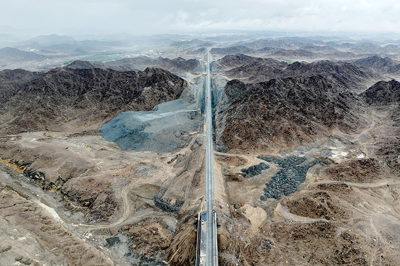
The Etihad Rail is possibly the biggest megaproject the UAE has undertaken, and everyone is excited. The UAE’s very own ‘Sanpiercer’ (not the official name) will link all seven emirates by 2030. And, if you’re wondering what the Etihad Rail route map will look like, you’re in the right place.
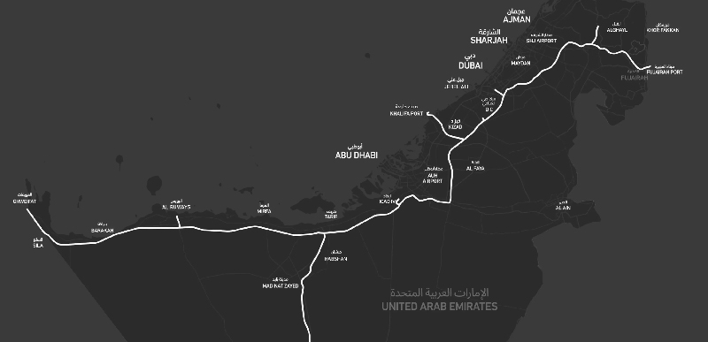
Etihad Rail will travel across the seven emirates, connecting 11 cities and regions from Al Sila (bordering the Kingdom of Saudi Arabia) to Fujairah.
When What’s On spoke to Ahmed Al Musawa, CEO of Oman & Etihad Rail Co on the travel time between the emirates, he said: “Train passenger services will enable users to plan their journeys between the emirates and cities more efficiently, significantly decreasing the travel time:
- Travelling from Abu Dhabi to Dubai will take up to 50 minutes
- Travelling from Abu Dhabi to Fujairah will take 100 minutes
- Travelling from Dubai to Fujairah will take 50 minutes.
- Travelling from Abu Dhabi To Ruwais will take 70 minutes”
Al Musawa added that the 1,200 km network will serve 11 cities, towns and communities around the network, including Ruwais, Al Mirfa, Fujairah, Sharjah, Al Dhaid and Abu Dhabi.
You can read the entire interview here.
But is this the end of the line?
The short answer: not at all!
In February 2023, Oman Rail and Etihad Rail struck an accord, partnering with Mubadala and committing to a 303km stretch of track that will unite the two GCC nations by rail, direct from Sohar in Oman to the city of Abu Dhabi (in just 100 minutes) and beyond. It will also stretch westward to the borders of Qatar and Saudi Arabia
In even more recent news, the UAE also signed a contract to work with Jordan in constructing a 360km rail network. It could mark the first tentative steps of the next phase of inter-regional passenger travel for the GCC.
If you want to know everything there is to know about Etihad Rail and to stay updated with all the latest, read and bookmark this page here.
Images: Etihad Rail