Dubai Metro Blue Line: Here's what the route map could look like
And more of what we know about the 18 billion dirhams project…
The Blue Line for Dubai Metro was first discussed back in 2006, along with other potential lines and expansion of the existing Red and Green lines. Plans changed amid the global economic slowdown, but the Blue Line is once again back on track. The project has been officially approved by HH Sheikh Mohammed bin Rashid Al Maktoum Vice President of the UAE and Ruler of Dubai.
Construction is set to begin on Dubai Metro Blue Line this year and if you’re curious…
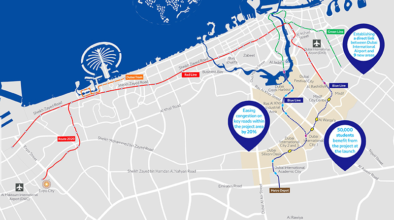
Here’s what the route map of the Dubai Metro’s Blue Line could look like

The above map was shared by Dubai Media Office back in November 2023. Although not confirmed, we now know more or less what route the Blue Line will follow when it is operational.
The Blue Line will connect to the existing Centrepoint station on the Red Line, and to Creek station on the Green Line.

From Centrepoint, the Blue Line will run through Mirdif where there will be a station (most likely) outside Mirdif City Centre Mall. From here it will pass through Al Warqa and then Dubai International City 1, Dubai International City 2 and 3, and Dubai Silicon Oasis, before arriving at its last station at Dubai International Academic City.
From Creek, the Blue Line will make its way over the Dubai Creek and will have a station in Dubai Festival City and Dubai Creek Harbour, before moving to the Ras Al Khor Industrial Area. From here, it will move towards Dubai International City 1 station, where it will connect with the line coming from Centrepoint – essentially making this metro station a junction (transfer station).
*Etihad Rail: The route map for the train linking the seven emirates*
With the launch of the Blue Line, Dubai International Airport will now be easily accessible to people staying in nine new areas. The new route will also benefit students in Dubai International Academic City, thus reducing the need for buses, taxis and personal cars.
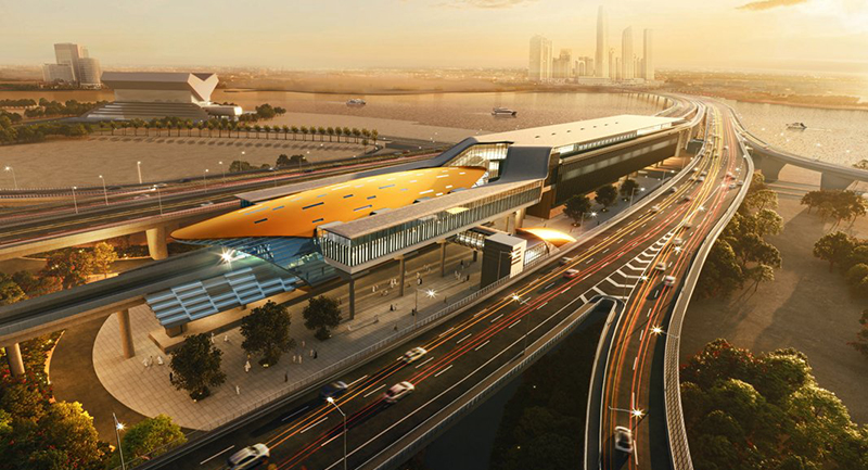
The majority of the 30m track will be underground (about 15.5km in total) to a depth of up to 70 metres, with five (marked in yellow on the map) of the proposed 14 stations being designated as ‘underground stations’.
As for a completion date, we don’t have confirmed news yet, but according to reports, the launch will coincide with the Dubai Metro’s 20th anniversary in 2029.
We will be keeping our eyes on any progress announcements made during the construction.
Images: Dubai Media Office
